Day 104 – QC to ON. A small ferry + a large driving day

Tuesday November 13, 2018 (full photo album here)

A slow start to the day, embracing a bit of extra sleep. I rolled out and stopped by the Canadian institution they call Tim Horton’s for a farmer’s breakfast wrap and a Coke. An oddly blended American and Canadian fast-breaking assortment of bad choices!

The further I got towards the St Lawrence River, the more signs I saw – including the suitably understated Canadian shorthand for “the road ahead is worse than your typical World War I no man’s land artillery cratered-field”:

A very long day of driving followed that brief bout of laughter. The first half was a wintry mess, which did not lend itself well to many photos. Some time later, I found myself suddenly arriving at Tadoussac and taking the free ferry. My Quebecois interlocutors were SO HAPPY when I spoke French to them, and helped guide me to a spot on the open deck (off to the right of frame):

I used the facilities and stretched my legs inside, a bit uncertain about the seemingly calm water which might be concealing U-boats or icebergs or the like…

Back into the truck and gingerly off the ferry onto land. Back into a wintry mess of roads and tangled traffic in unexpected places. Then of course the fun (and terror) of only remembering that “Vitesse” is French for “speed” and so the green signs with a stylized camera were speed camera warnings… and not weird scenic overlook signs. No ticket emailed home would be nice, but I was not holding my breath at the time – I know I passed at least 6 or 7 VERY slow drivers and my passing speed was likely over the limit. So it goes.

Then a sign whose translation was clear – “hold onto your butt”:

Eventually, after following the beautiful St Lawrence River for a great many miles, curving a bit inland… I found myself having a Subway “lunch” at 4:45pm. The girl working and I shared a laugh when between French and English, we both realized that Subway branding was not bilingual even if the rest of the menu was – so I ordered “un footlong avec poule.” Ha! Even the drink machine was fancy and French:

The winter mess of weather had calmed a bit as I ate, which meant I was able to engage in that most important of tasks, adding Quebec to the tableau on the tailgate:

It was ~11 hours after I had departed that morning, and I reached my second-to-last Canadian province, and crossed into Ontario.

I was exhausted and ready to be done driving, but nevertheless elated – I had made it. I was within sneezing distance of the Ottawa International Airport where I needed to be early the next day for a flight to Nunavut. In a few short days I had traversed the second half of Canada in some of the most adverse weather thinkable, by myself, on the most adverse roads possible (namely: the only, unpaved road)… in a rig of my own design…… on tires well beyond their useful life. I am not pulling a Boris, as I was not quite convinced of my invincibility. But gee golly did I feel good about achieving another of the ridiculous sub-goals necessary to achieve my overarching ridiculous goal.

I was a wreck of tired and overworked with driving, when I finally reached the Ramada nearest the airport. The melting heat inside the room was in stark contrast to the outside, it did not help with keeping me very focused, but I made myself do the dance of unload too much from the truck to repack it and make it suitable for airline travel… and then try to shove all those things back into the over-full truck.

But I did it. I was packed, I was prepped, I was back in the room and immediately out cold in that sauna/room.

What a rush, what a day.

Day 101 – NL to QC to NL. A Ferry + the Trans-Labrador Highway + No road at all.

Saturday November 10, 2018 (full photo album here)

Burning eyes and slightly sick stomach and punch-drunk sensations as the 4 alarms in a row (with 2 minute intervals, so failing to snooze one would not sink me). I got myself awake (ish) and showered (ish), and packed (fully).

I am neither a coffee drinker nor a believer in other caffeine when overly tired (as I know how bad the crash is when it wears off). This high and mighty position folded, on this Saturday. I bought a 12 pack of Coca Cola and started the day off wrong, with sipped cancer water well before 6:30am.

It would be more accurate to say “I stumbled the truck” as opposed to “drove” when describing my path over to the ferry’s staging area. Far smaller than the North Sydney shipyard, this has a total of 5 lanes painted on the ground. For reasons which escape me, I arrived late compared to many other people and yet I was put into the first position on the lane closest to the ship – which did indeed mean that I would be getting onto and off the ship first. This was a reasonable consolation prize for such an early morning.

The truck was parked and I went upstairs to the stern-facing cabins. I got a few pictures of Sainte Barbe…

… and with little ado, we were underway. Stepping back in from the intense cold Atlantic sea air, I managed to get into a serious conversation. I was chatting with an elderly local about his fishing trips up to Greenland during which whales surfaced, gently bumping his boat off course. He advised a slim chance of seeing a whale, as the peak season was over in October, but that I still might get lucky on this crossing if I was up on the deck. I thanked him (also shacking my head clear of the THICK Scottish-esque accent I struggled to parse out) and ventured back onto the deck of the Apollo…

… which was named for the god of the sun (whose solar body was, mostly, visible but not helpful with the whole provision-of-warmth thing). It was a diesel ship with a single massive smokestack, the basso thrum from which shook my very rib cage into a dust-free state. I was in a certain kind of diesel heaven, even with the unfiltered exhaust wafting down over me. I kept dipping in and out of the windy cold, keeping my eyes wide open for signs of whales on the choppy seas. Not much whale sign, but I had more insight into the nearly impenetrable accent I kept banging my head into. The warning signs had Finnish and Swedish, but that still didn’t capture the Scots Gaelic and Scottish accents coloring the local dialect of English:

I continued to try for spotting one of the largest mammals known. No whales, but plenty of beautiful purple black water and freezing cold wind to enjoy:

My (ridiculous) in and out was noticed by the Canadian folks crossing, who could not understand why I would voluntarily go outside in that level of frigidity. So a few times I now conversed with another gentleman from Labrador, or at least I tried to do so – this accent was nigh impenetrable. And yet, we still managed to share a bit of our tales. He got the picture of my trip and made damned sure I had at least 2 spare tires if I was serious about the Trans-Labrador Highway (I had 3, having done my homework). He also let me know that I should expect to be in 4×4 the entire time, and comfortable with slower speeds even if it made for miserably long days of driving. After all – there are only a handful of stops along that very long and lonesome road.

I stepped back out and saw we were close enough to the mainland to discern that the storage racks for fishing boats was bigger than the town itself:

Soon thereafter, we docked the Apollo a good 5km in Quebec from the Labrador line, and my prime real estate in the cargo hold saw me freed quickly and effortlessly. I topped off my fuel at the only fuel station in town, which was prohibitively expensive , of course ($4.504 per gallon, even with the favorable exchange rate). I caught a glimpse of the Apollo from across the bay in the daylight:

Thus began a drop dead gorgeous day of driving across coastal Labrador up into Happy Valley/Goose Bay. Over 200 miles of unpaved road and increasingly winter conditions made for a long day, of course, but I cannot easily explain my excitement at seeing a sign which a TINY number of people have the gumption to reach, the proper welcome into Labrador from Quebec after that ferry:

This was reason enough to stop, gently clean the map of dust and grime, and apply the newly-earned sticker onto the old tailgate cartogram:

ESPECIALLY given the close call of the night before, I saw a far more important sign soon thereafter, warning me again of the realities of the moose infesting this easternmost portion of the Canadian mainland:

A few times I stopped to see the view, to learn from any signs, and grab a few bits of photographic evidence of my glee at this chilly landscape…

… or, in some cases, the ultra-exclusive “blank sign” which isn’t at just any scenic overlook, after all:

My Newfoundland experience of a color palette skewed further towards prevalent crimsons and grain-colored grass was not just echoed in coastal Labrador…

… it was joined by the deepest shades of green and hints of blue/gray stone, and then my absolute favorite – the pure white of snow:

Nestled amidst the riot of colors which were etching their own spot in my heart, there were a handful of moments of oddities, like someone’s inside joke about Camp David:

The most interesting of the signs on the trip, maybe, was learning that Newfoundland and Labrador did have a 30 minute difference to Atlantic Standard Time (too late for me, as I only got a sign as I drove back into AST):

Sometimes, one has to travel hundreds of miles away from civilization to park their mushing sleds on the side of the road, upside down…?

The miles and hours wore on, and the light patches of snow gave way to my preferred native environment – boreal forest with icy and snow-covered gravel ruts they were labeling as “road” – I was in heaven:

For the view of anyone behind my truck (and that itself is an interesting detail, I saw almost no other human beings for many hours at a time for the day and those ahead), this is my idealized form of “the open road” in a single photograph:

Night began to fall, and I got in the vicinity of the only stop in range – Happy Valley/Goose Bay. Camping was quickly ruled out (everything is closed in eastern Canada, after October 1 or so) and it was frigid – no pull-offs or side roads meant no boondocking either. So: a hotel. But that was secondary.

First, food – I decided to enjoy dinner at El Greco, a pizza place. I savored the pizza, all the while chatting with the Filipina girls working there about how they had done a work program to earn their citizenship and loved it there in Happy Valley. This was yet another moment on the trip where I could feel some of my deepest concerns (in this case, being consumed with worries about what I meant to do, eerily similar to this article I found the other day) being whacked in the face by my encountered facts on the ground. These girls had left a country they do love with humid heat for one of the more remote parts of frigid Canada – they were working a job they admitted to not really being excited about directly. Even still – they are evidently grateful as can be for the opportunities afforded them in earning their citizenship in Canada while also learning a lot about operating a business in adverse conditions (in terms of weather and supply chain, alike). They rejoice at the chance to get to know their new neighbors (another common theme of my favorite people and places – those were genuine social engagement are at least partially required because of remoteness and/or wilderness). They are living their lives in an engaged and upright way, and filled with gratitude about it. I am, unfortunately, not able to claim that this chat was sufficient to see me break free of my self-reinforcing prison of worry about my purpose and trajectory. It was food for thought, just as wholesome as the handmade pizza was food for the belly. Full on both fronts, I wished them all well and gingerly tiptoed across the icy deathtrap of a parking lot to my truck.

I rolled a few streets over and got a room at one of the only hotels with an opening, the Royal Inn Suites. The room cost too much, the accommodations were rather plush, and my being forced to call it a day at 6pm (not able to drive to the next town) meant that I had a chance to actually recuperate a bit from the past few day’s terrible marathon sprint

I was idly curious about how far it would be from home in Chesterland to my last Canadian province on the list, Nunavut… and Google Maps rightfully threw up its hands in frustration at the lack of roads to that remote wilderness:

No matter. This trip was a series of “wow, THAT was far away” in a row and the final week of the trip (which, as I sadly mused, would start the following day) was going to be no exception. Quite the opposite, it would be VERY FAR AWAY indeed.

Day 100 – Newfoundland + Gander International Airport

Friday November 9, 2018 (full photo album here)

Deep breath in.

Prepare yourself for a chronicle of a long day.

Deep breath out.

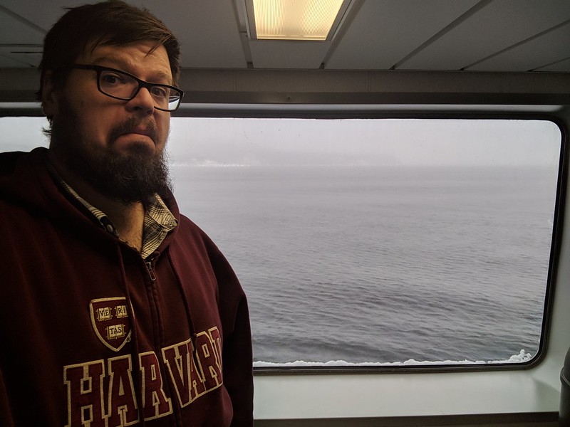
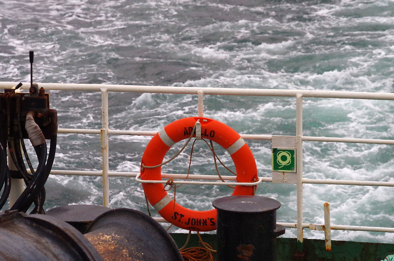
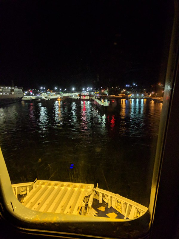
My visions of the Titanic were not so far off-base. I got very poor sleep indeed, because the horrifying rocking of the ship was reminiscent of the rockiest roads I had driven – but amped up enough to make me feel slightly motion sick. So reveille was not enough to wake me up – it took a steward hitting on the door to remind me to wake up as I would need to get off the ship to wake me enough to get my butt in gear. The initial 5:50am wake-up call was miserably quick after an 11:40pm departure the night before. The dreariness of the view outside the porthole was not impressive, but I was groggier than the average grog-brewing grognard I am:

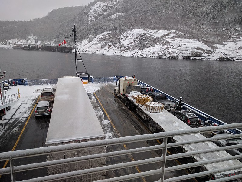
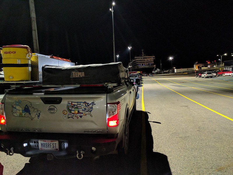
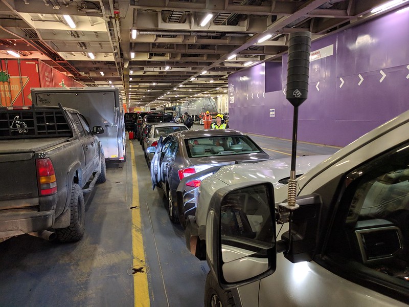
That was the prerequisite step to getting my gear and then putting the truck in gear. Sadly, the tiny (and innovative) shower in the suite had to go unused in my limited time to make it to my truck. But I did make it, and felt my inner ears confirming the rolling ship even though the cargo hold had no visible look at the roiling seas. I was ready to get off that ship, and my wish was soon at hand:

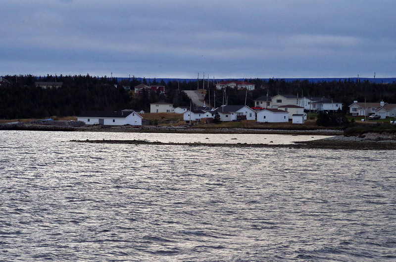
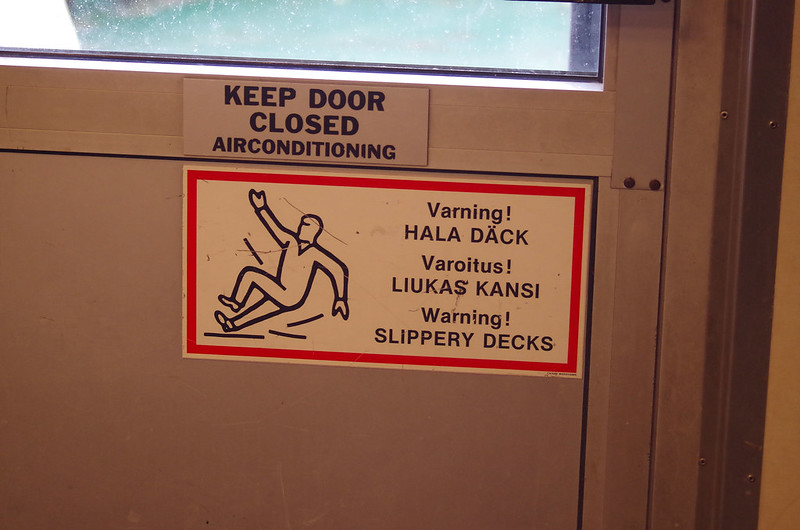
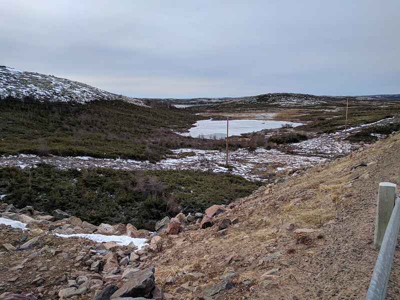
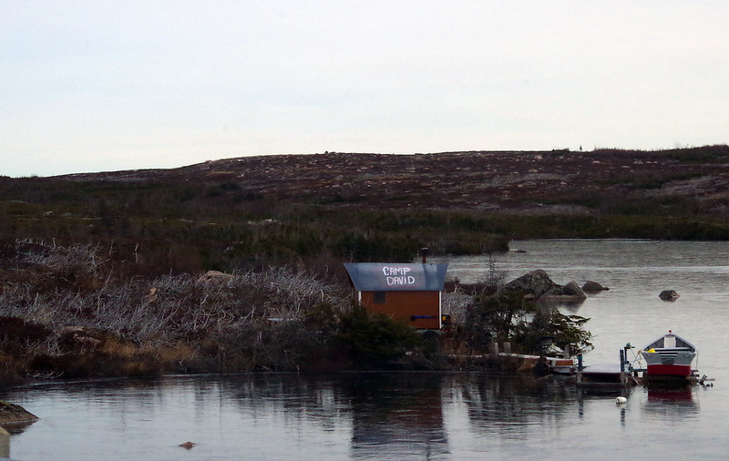
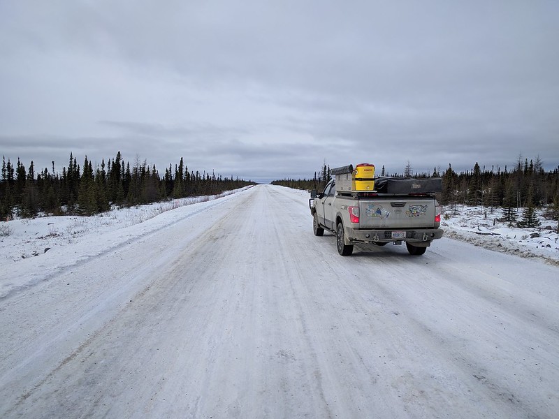
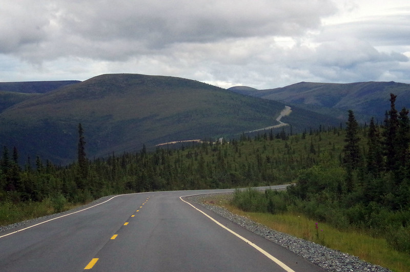
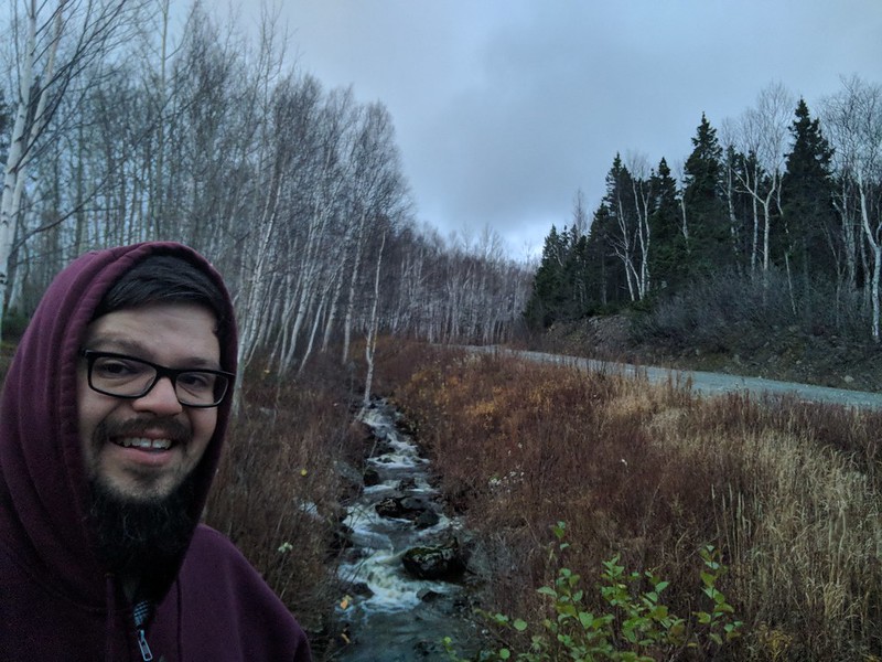
The stylized reenactment of D-Day was upon me, and it was a fairly peaceful one – we all drove off that monolithic landing craft in an orderly fashion, with safety orange-suited workers guiding us to the bright exit ahead. Rolling down the ramp slowly and carefully, I immediately revised my initial porthole opinion of the dreary landscape, because I recognized it for the Atlantic ocean-facing paradise it was:

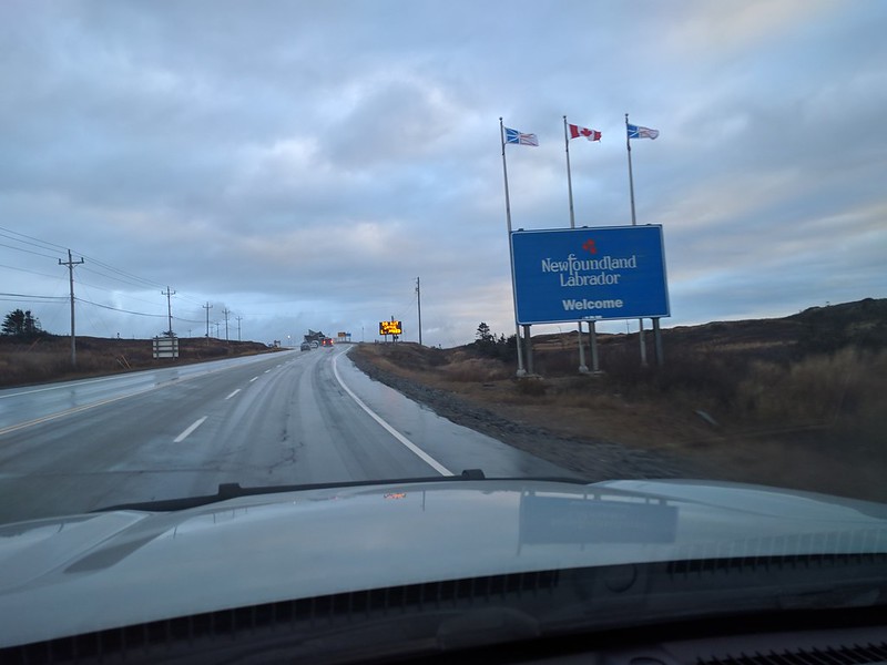
A muted palette of pastel colors is just fine by me, and in some ways is preferable to a riot of colors. Muted natural beauty allows for a more even-keeled appreciation of one’s surroundings, and therefore a better and more precise focus on the deepest worries rankling one’s soul. Ask me how I know.

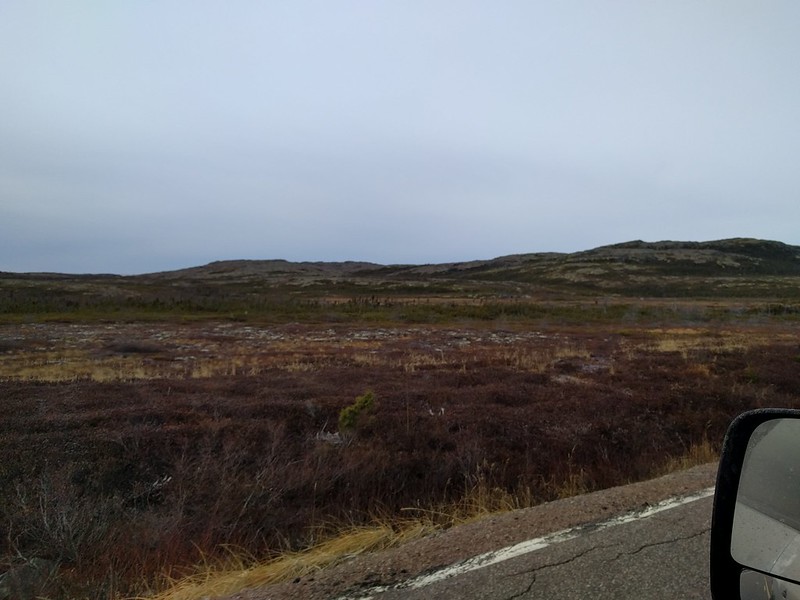
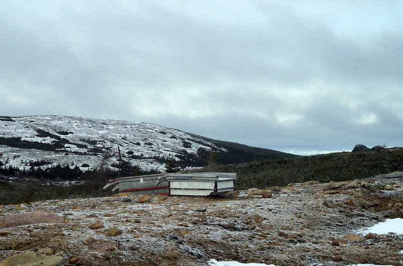
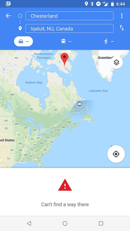
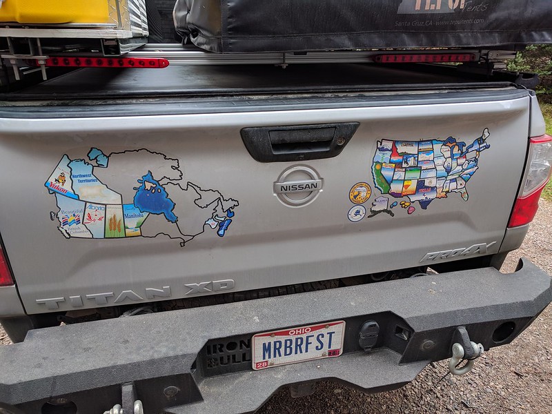
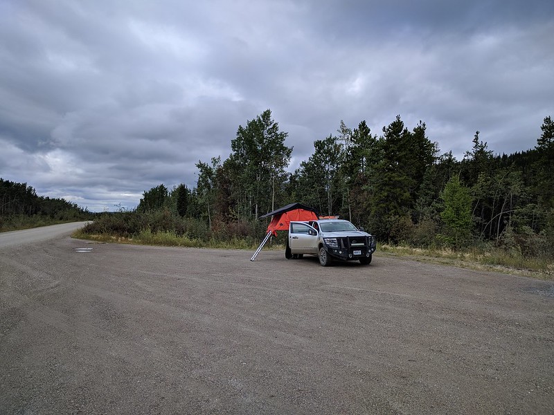
I got my heavy dose of muted colors, because the day was filled with a long drive through rain, sleet, snow, sun, clouds, and cold. All the way to Gander International Airport, as a matter of fact. I had a brief stop for my one and only Canada Post errand, to send a thank you card to Murray of Muzzie’s Crokinole. I also left the truck running and jumped out of the truck for a couple of sample shots of the deepening crimson reds and straw yellows overtaking the color palette of nature all around me:

My introduction to Gander was from my friend Jim, and this link: https://99percentinvisible.org/episode/gander-international-airport/, some 10 months prior to my visit. But, in short, I knew it was a place drenched in history of a peculiar sort – it was an airport of military necessity, and one which became a civilian airplane hub after the war as trans-Atlantic flights became popular but the distance eluded range limits on planes for decades. The story would deepen as I had another one of those chance encounters this trip was overloaded with, as it turns out.

The North Atlantic Aviation Museum in Gander was the chance encounter of the moment. From walking in under the tail of a (presumably) crashed airplane through the building…

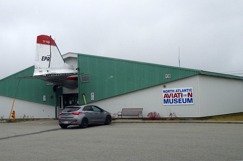
… I knew I was in for a treat. I was not disappointed.

In truncated list form, I learned about

  • Early history of the airport as it was carved out of true wilderness:

  • World War II history, including the fact that on a remote Canadian island there was sabotage on bombers destined for the UK:

  • The history of airmail, taken for granted now, but they saved the first envelope sent to Prague successfully (and then returned, with both postmarks visible):

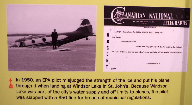
  • The almost incomprehensible realities of safety and regulation, when crashing a plane into a frozen lake would yield a $50 fine (and nothing else) as recently as 1950:

  • The astonishing fact that Fidel Castro (one of a slew of celebrities who had gone through Gander because they had to do so) had learned how to toboggan while there (because of course he did, and of course a local person snapped these iconic photos of it)”

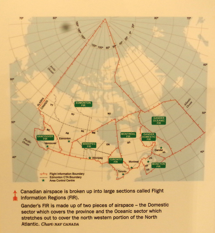
  • Glancing at the intensity of aircraft routing operations over the Canadian areas of responsibility, which extend all the way up to the North Pole:

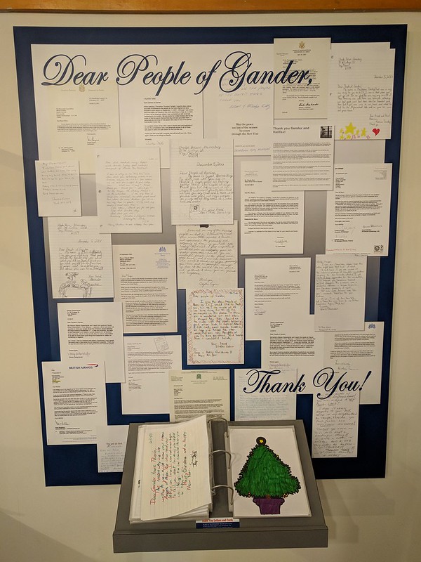
  • Learning the breathtakingly touching story of how the people of Gander took in thousands of stranded airliner passengers as their flights were grounded in the aftermath of 9/11 as a part of Operation Yellow Ribbon. These letters were a fraction of the love sent in paper and email form to the people of Gander, and I highly encourage you to take a minute or two to read about their selfless love given to strangers at a time of fear and loss:

More photos and tales of this museum (and the rest of the day) are in the photo album.

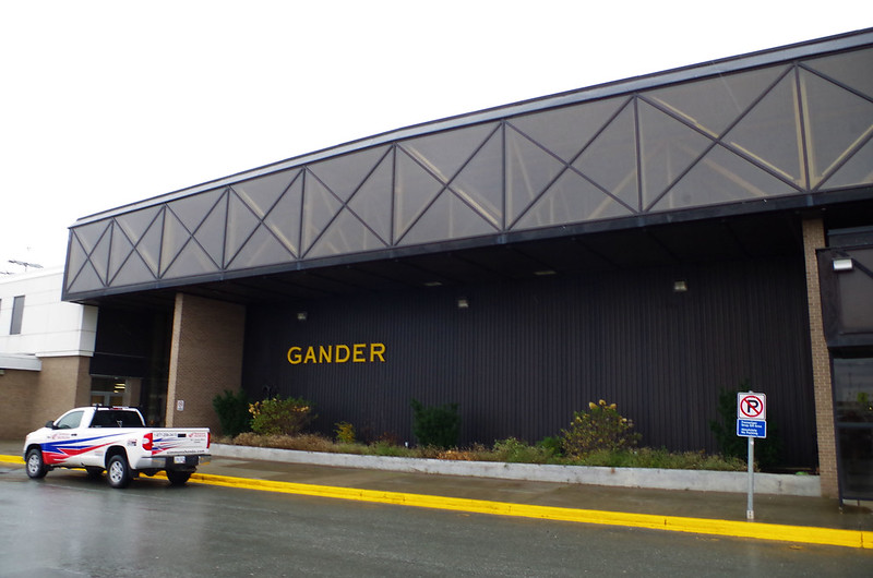
The truck hadn’t fully cooled and I got it running again, to rush down the road to the main course, Gander International Airport itself. I was very glad that I made the spur-of-the-moment decision to do the Museum before the Airport. It had taken me almost 7 hours of driving to get there, but I had arrived:

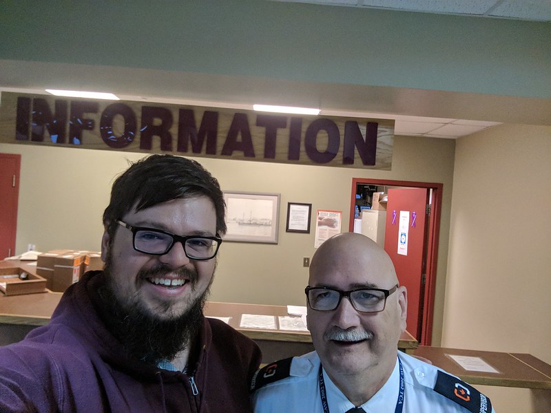
I parked in the departures lot, walked inside, and asked after the security guard named Jerry (at the advice of the Museum staff). He was even glad to get his photo taken with me as a part of his tour of the place (I told him he was as famous as the building he was showing off, and that made him smile):

His tour was excellent, and included details ranging from the portion of the original international lounge from 1958, still maintained as it was then…

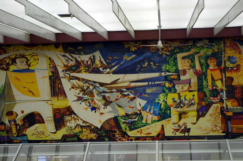
… to the preserved ladies restroom where the Queen of England had powdered up prior to the inauguration of the airport (years and years after it has been operating). There is a famous mural in the international lounge depicting many of the elements involved in the airport’s evolution and reality…

… and then you have the people themselves, working the airport. Some of them, aircraft crew and ground crew alike, have logged an incredible 40,000 hours on the job. Not a low-pressure job, either. I could have spent a dozen hours on site, not least of all to watch more propeller planes take off and land (a common sight in Canada, I found), much less explore the history. But I settled for a couple of books from the gift shop at the airport before hoofing it out to the truck.

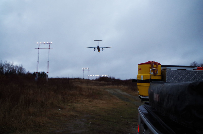
I turned left, eastward, out of the airport. Another fact discovered at the Museum was the sad story of the Arrow Air Flight which had crashed in 1985, carrying American soldiers returning to Kentucky from Egypt. The Silent Witnesses Memorial, on site, was said to be a hauntingly beautiful place to visit. I rolled down an unclearly-marked access road. The roughest gravel did not inspire confidence – neither did realizing I was on what appeared to be the access road for the landing field beacons for the Airport. I got out to check the map on my phone, and then I had the delightful pleasure of a twin propeller plane roaring in for a landing no more than 100 feet over my head, before I twirled and got a photo of it flying past me to the runway:

Shaking off WWII flashbacks from the sounds of that plane, I rolled further down the hill as it looked like I was in the right place. I found the memorial:

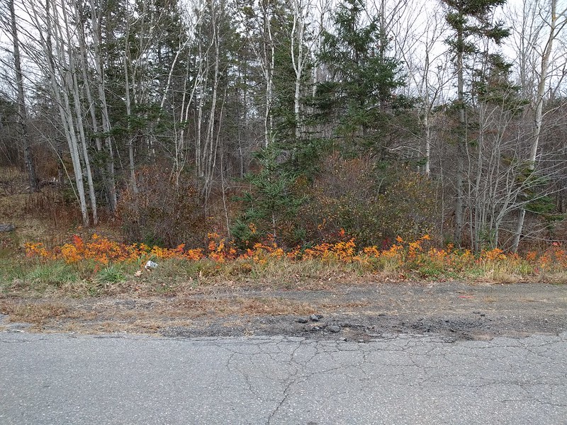
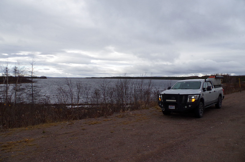
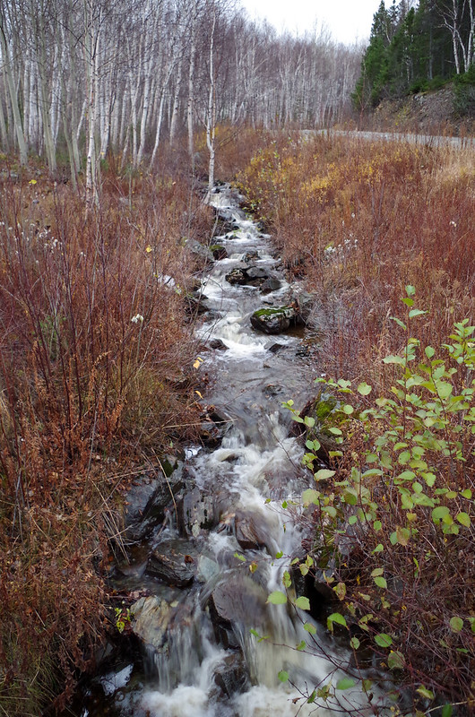
The sun was setting. I took a moment to soak in the beautiful color palette of this easternmost point I would reach on the point…

… and then I turned around and began the next leg of one of the longest driving days on the trip. I had made it across almost the whole width of the island – I would need to retrace over half of those miles and then go almost as far north as I could go, to make it to the harbor in time for the next morning’s ferry to the mainland.

I eventually reached Eddy’s Restaurant after dark, starving and in need of a break from driving. Overhearing the thickest of accents, I scarfed down a meal of cheesesteak and salad, trying to figure out if it was Scottish or Gaelic or something else I was hearing. I am typically halfway decent at parsing out accented words, but I was getting maybe 1 out of every 8 words. I knew I was tired, but not THAT tired. Something to ponder as I drove (and drove. And drove).

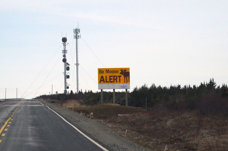
I went another hour or so, and then had to come to a quick stop when I realized that traffic in front of me was not slowing down, but stopped in its tracks. As I slowed down I saw a hulking shadow on the side of the road. I had the split second question “is that a moose??” pop through my brain and then I was stopped. After 20 minutes of waiting, I decided to get out and jog past the dozens of cars now queued up behind me. I grabbed a few photos in the darkness vs bright headlights (challenging photographic circumstances, especially given the unknown amount of time left to our being stopped. Fair warning, I have added some spacing here as the moose’s carcass is pictured below…

.

.

.

.

.

.

.

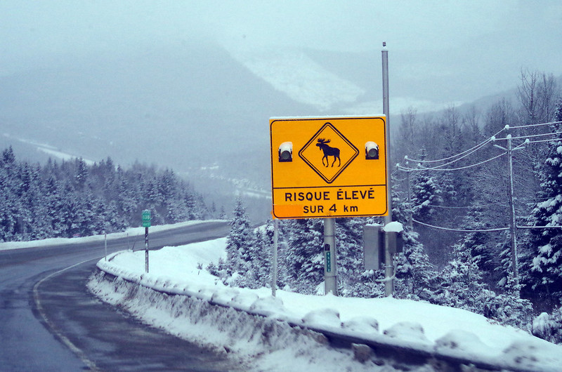
The ambulance blocking the road ahead departed and we slowly started to move. This allowed me to see that the wreckage all over the road had been caused by the car which presumably hit the moose and killed it, before the car barrel-rolled off the road into the forest. I hope those poor people were OK, but it set my exhausted brain into overdrive in the darkness. I knew I had to travel along the mountains on the island, overlooking the Atlantic Ocean, and that the weather forecast expected snow.

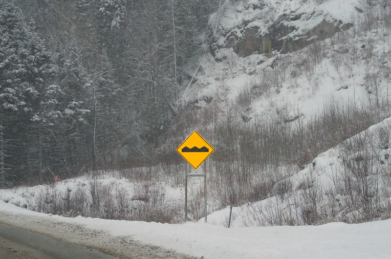
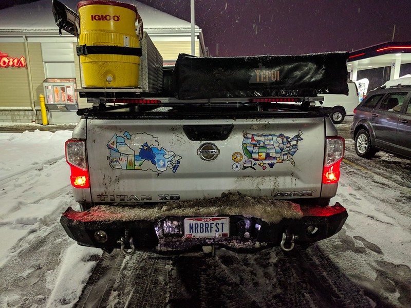
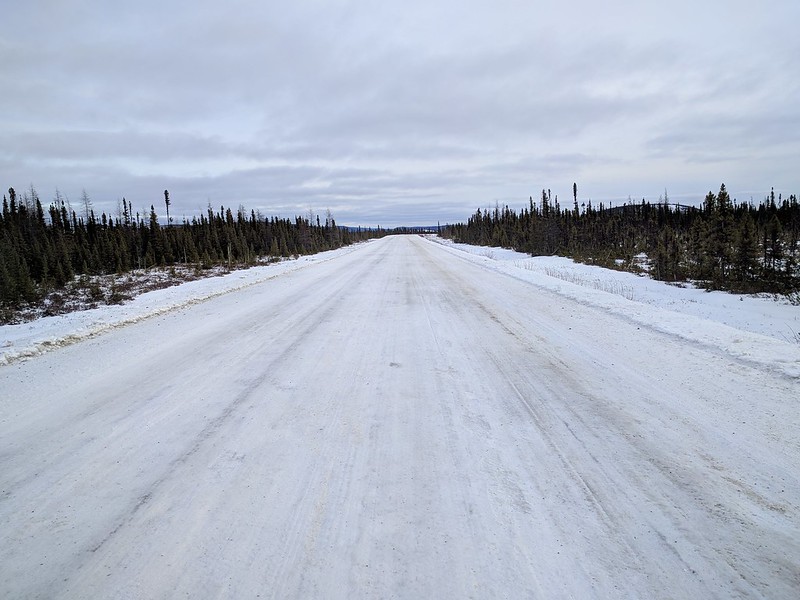
My harrowing nighttime drive did not disappoint – it was pitch black AND had intermittent bouts of snow:

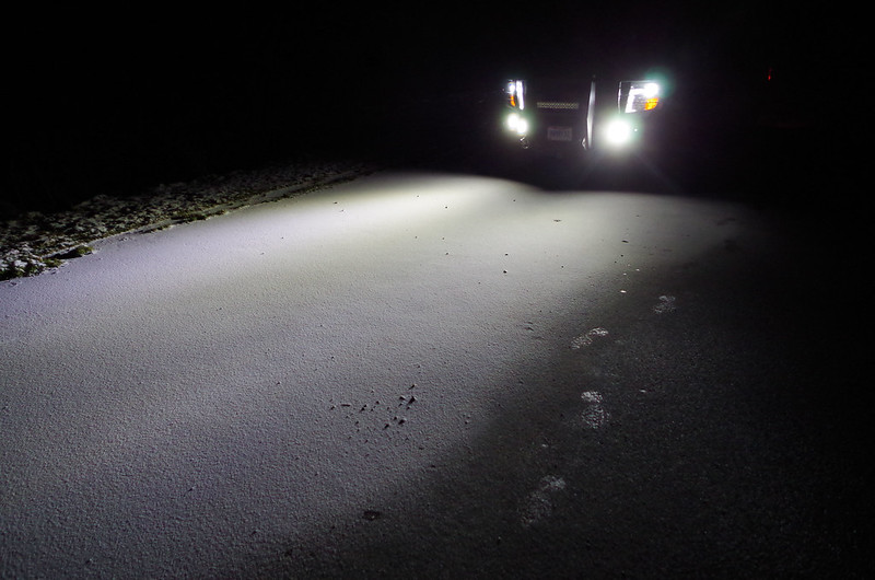
I was, after a gross number of hours of driving all day, maybe 15 minutes away from my destination of Saint Barbe. I had all of the auxiliary lights on the front bumper alight, and so you will understand my abject terror that I saw a moose maybe 5 feet from my truck to the right only as I was passing it… those tales of moose having non-reflective eyes were all true. I did not swerve, I did not have my life saved by my front bumper – but it was close. It was only dumb luck that I did not hit that moose (and thus did not careen off that mountain into the ocean below; or die from impact; or something else nasty). Life is short, and life is precious – this being the second time in the evening I saw someone’s life threatened by dumb luck and natural forces, I was white knuckle driving the final miles to my destination.

Eastern Canada being closed, and with no camping options at hand, I settled on a painfully brief night’s stay at the Dockside Motel in cabin #2. I arrived well after 1am, and I would need to be awake before 530am to make the ferry back to the mainland.

Moose, weather, distance, endurance, and worse had not stopped me.

Being more tired than ever before would not stop me, either.

Day 99 – PEI to NB to NS to NL. Crokinole + an Atlantic Ferry

Thursday November 8, 2018 (full photo album here)

As I explained at the end of the prior night, I found out that campgrounds all across eastern Canada were all closed for the season. I woke up and did a slew of Google searching only to find that many of the interesting sites on the island were either closed or on reduced winter hours. The options which were open, like the Canadian Potato Museum, were too far away for me to reach and still make it to my ferry on time. The morning on PEI was, as a result, brief and disappointing. I turned around and aimed at that same Confederation Bridge to make it back to New Brunswick.

The only shot I managed of beautiful and green Prince Edward Island before hurtling back onto the mainland for a LONG day of driving:

Maybe next time I go there, I can enjoy the place a bit (and then pay the stupidly expensive toll to cross back to the mainland, of course, too).

A lot of driving was ahead of me (as if there was anything else on my schedule). Reaching the Nova Scotia line after a bunch of hours…

… I reached a fuel station at the crossroads I would visit twice that day – instead of going east towards the ferry, I headed southwest. Why? I was on my way to meet the owner and operator of Muzzie’s Crokinole, one of the businesses which manufactures the eponymous crokinole board. I had been emailing back and forth with the owner, and had mentioned to him my interest in visiting. I had no intention to bring many souvenirs home with me from the trip, but I had hoped to see about a custom crokinole board to commemorate my trip. My friend Justin, visited early on this trip in South Dakota, had introduced me to the game – his board is a wall hanging, decorative and art deco in appearance, and then comes down to be played when desired. The owner of Muzzie’s, named Murray, had been willing to have me stop by to check out his shop and chat about the custom board. It was pretty neat to see the shop…

… and even more interesting to see his growing international map of “where has he shipped crokinole boards”:

Perhaps most interesting of all – the only continent he hasn’t shipped to is Antarctica. One idea which had been brewing in my mind all trip was about what a sequel trip might look like (in very short: the pan-American highway, from the Arctic Ocean down to the southernmost tip of South America… and then take a ship to Antarctica. As I promised Murray in person, if I ever saw that dream through, and made it to the chilliest continent… I would be bringing a crokinole board as a gift to one of the research stations. How cool would that be?

I thanked Murray for his hospitality and his time, and after he helped me refill my water tank with his tap water. The last step, as the truck warmed back up, was to add the all-important sticker before departing Muzzie’s, for Nova Scotia:

Fiery orange flowers across Nova Scotia, and I captured some of the most fiery of all right outside of Murray’s house, and it was worth a stop to snap this:

That was the last stop of the day until I reached the city of North Sydney. I had a ferry to catch and it was the only one that night. No margin for error, no chance for redoing it, no wiggle room. I had two consecutive days with prepaid ferry tickets, and then plane tickets a week hence. I was going to make it.

So, I did.

I made it with about an hour to spare. I circled the entrance and then went beyond it to refuel on Nova Scotia (both due to needing fuel, and to an accurate guess that the fuel on Newfoundland would be more expensive). I looped back around, got tricked by poor road design, and then found myself queued up in the shipyard with its 2 dozen lanes painted for commercial and passenger vehicles alike to queue up, with gigantic ferry ships in the background:

Astonishingly enough, the ferries were even bigger than they appeared, with 4 or 5 decks of this cavernous size, chock full of vehicles far larger than mine, and so I was eyebrow-cocked at the odds of this parking garage they called an oceangoing vessel:

With visions of Leo and Kate Winslet rushing past me in the hallways of the ship, I took an elevator several decks upwards and eventually found my room:

It was to be an oceanic voyage of 8 hours across the Atlantic in early November’s wintry weather and whatever intense seas that might bring. I was glad to have paid for the cabin and a chance at sleep, instead of the cheaper upright seats in the main deck.

A chance at sleep and, by chance, the unexpected boon of a stern-mounted room with a porthole aiming my camera at the port of North Sydney:

Day 22 – AK to YT, via the Top of the World Highway

Tuesday August 14, 2018 (full photo album here)

The cold and rains and cold rains all stayed overnight in Fairbanks – I was vindicated, upon waking up in a not-cold, not-wet hotel room, to have prevented my getting more sick from the weather. The sad weather was a fitting meteorological funeral dirge to accompany leaving a place I had fallen in love with, far sooner than I wanted to leave. People had joked (or “joked” perhaps) that going to Alaska so early in the trip was a bad call – I would not be able to leave. I think they discerned a very real truth. Such is life, at times.

First stop for the day: back to the Three Bears Outpost in Tok. This is where I picked up my big honking revolver – and it was also where I would ship it back to the lower 48. Specifically, to the shop in Montana near the border, so I could pick it up along with my 9mm already shipped there from home. The manager Mike who helped me sign for it on my way in also helped me ship it out – he seemed pretty impressed with the whole story of my trek, but particularly that I made it back as a non-hunter from camping on the tundra!

In the parking lot (as it was also a gas station and campground, besides just a wilderness outfitter), I met a couple of guys coming down from a successful caribou hunt on the tundra…

… and I was impressed by their tale of how their UTV had done an incredible job of pulling the caribou carcasses up the side of a mountain, without much of a struggle at all. Impressed, already considering “which gear would I want or need if I did move up to Alaska,” and frankly too avaricious (when it comes to certain neat tools or toys) for my own good… I asked a bunch of questions and set in motion one of the B Plots of my trek – looking at and asking after the more-ubiquitous-than-you-might-think UTVs of the world. A silly but altogether in character variation on the theme of “but seriously, Mike ADORES utility in and around his life” – and so worth at least mentioning in the chronicle of things which happened in the external world as well as in my mind.

I was off, again – this time, heading towards the Top of the World Highway. It turned out to be erroneous, but I had heard from several travelers that this route back into Canada was just chock-full of wildlife. Mike at the Three Bears Outpost had also mentioned that he had done it once and didn’t need to do it again, but that it had had some very nice views for him. Given that I did the other route once already, I figured I’m here now, so why not give it a try – I selected my fate the Top of the World Highway. The route looked beautiful and rugged as I approached…

… but this nice patch of paved road and plenty of space quickly gave way to a far less hospitable driving surface. I looped my way along increasingly treacherous cliffs they called “roads” and made my way through the small and somewhat famous town of Chicken Alaska

… unfortunately not having the time to stop.

Finally, rough road gave way to dirt and gravel, and dirt and gravel eventually gave way to about 1-1/2 lanes width for the whole dusty path. This wouldn’t be so bad on flat land, except the highway does its best to live up to the moniker Top of the World. It began snaking its way up the side of a rather steep set of mountains:

… and that is a bad fit for, say, a Mike who is deathly afraid of heights. One of many moments on this trek where it was do or die and time to build some character by surviving things of great distaste – because the slim corridor meant that when I was on the outside lane I was looking down over at 1500-2000 foot drops, with no guard rails, and insufficient room to move out of the way when the inevitable semi truck or dually pickup truck towing a boat rumbled by me. I even captured a bit of video, to commemorate JUST how white my knuckles can turn when death-gripping a steering wheel!

The worst of the Top of the World was finally behind me, with the road spreading back out to 2 lanes and eventually even pavement anew. Upon reaching the Canadian border, I got the requisite questions about whether or not I had anything such as firearms and bear spray. Having both, but also having the paperwork for both, this ended up being a very quick crossing back into our northern neighbor. Especially compared to my initial Canadian crossing, this likely went faster because they basically understood that I had been through their country once and had caused no problems. She looked at me through my window, took my passport inside the building for about 2 minutes, and then send me on my way. Easy enough.

A brief excursus but directly relating to the next leg of my drive: I’ve been asked the question many times, what is it that I do with so many hours on the road and especially those areas without cellular signal. The fact of the matter is, to do voice to text for blog post drafts (like this one!), I required a very consistent cell signal, not necessarily fast, but without interruption. As such, for those four or five thousand miles to and from Alaska where I had no reliable signal, I have done a combination of the following. First and foremost, I have enjoyed episode after episode of my beloved podcast In Our Time, from BBC Radio 4. I distinctly remember driving down from the Arctic Ocean and learning about fungi, for instance – not life-changing, but fascinating to be exposed to ideas and facts so far outside my daily life that it brings a smile to my face. Second, I’ve listened to my usual eclectic set of musical tastes, from death metal to hip-hop to Latin church music of the 1400s. Third and perhaps most interesting to me, I had picked up an audiobook at the suggestion of some old friends. With the pun title Investment Biker, this was the tale of a man who had made his fortune by age 37 on the stock markets of the world, and then embarked on a motorcycle trip to do every continent in a row. Certainly, a good thematic match for what I’m generally trying to do in terms of completionism on my own trek. I’m not quite finished listening to it at this point, but it has ended up being an interesting sort of prophetic text from the past, with his very pro-business views and political dispositions causing him to pontificate on all the ways the world would or should play out in the next 5 to 30 years. Interesting to hear him correctly diagnose the dissolution of Zaire, and incorrectly suspect that Canada in the Northwest and Alaska might well try to secede from the two countries they are currently part of. It was constructive to listen to as well, because it is basically the story of how a trip cannot be a story in itself. Most notably, the tale of his trip across the desert of Australia was reduced to a handful of moments, because they had very few problems and there was nothing to see. This audiobook turned out, more than anything else, to a series of lessons in being okay with things not playing out the way we expect or want them to, especially in the context of an intense journey. As a lesson I have long needed to better learn and accept, it was good for me to ruminate on rolling with the punches, as I rolled over the mountains and valleys of the Yukon Territory. 

I eventually hit the mighty Yukon River for the third time on my trip, and this time found no bridge in front of me. I passed a handful of signs, talking about how this was a free ferry thanks to the generosity of the Yukon government… and also how this was to be used at my own risk. Good! Looking across the swift-moving river, it was more than a little intimidating to see a handful of very large campers being towed by very large trucks, trundling on to this very small ferry which bobbed in the water. The river made such a boat seem like a child’s toy, to my eye:

At face value, this simple ferry crossing is actually another great example of the myriad ways that even on a trip supposedly in solitude like this one, I am so fully reliant on other human beings and the ingenuity of our species to get me through. I rolled up onto the newly empty ferry, getting the front row on the right side. This was beautiful, but also meant that I got to look over the lack of a gate right into the water, in front of my front bumper. The multiple signs along the ferry saying “PUT THE DAMNED CAR IN PARK” (I might be paraphrasing slightly) were there with good reason – even still, the scenic view ahead of me had the air of “but what if we hit a rock/get torpedoed, and sink… I will be going in first”:

Merrily floating across the Yukon River, passing a tugboat entertaining we named kid Commando…

… and wondering what prompted that name, we pulled up to what could only be described as the beach. No dock nor a harbor, no formal landing of any sort, I got to experience my own miniature D-Day and Normandy. Like a tank into battle, I turned the engine back on, disengaged the parking brake, and tried my hand at a beach disembarkation. In this case, the sandy unknown had very few Germans with guns, and instead had a little town called Dawson City (not Dawson’s Creek, which is what my eyes initially saw to my great surprise and mirth). I grudgingly patronized a very expensive fuel station, and ended up helping a small family of Russians in a rented Ford Transit van, struggling to get the hood open. This being my 4th or maybe 5th party of motorists aided on my trek (thus far), I wasn’t going to let a little thing like a complete language barrier prevent me from getting them safely on their way. Initially they made it seem like they had a serious concern about the coolant in the engine… but it turned out that they just REALLY wanted to refill the windshield washer fluid. They were, like me, aghast at how quickly and thoroughly the windshield gets caked in dust on these remote roads, reducing visibility. It was good to help them on their way again. до свидания (“do svidanya,” Russian for goodbye, literally “until the meeting”) to you, too, Russian tourists in the Yukon.

Speaking of checking vehicles, I did one of my innumerable visual inspections of my truck. Lo and behold, the front bumper being stupidly awesome (and heavy) but also having a design flaw in the mounting brackets, it definitely has a noticeable wiggle on bigger bumps. Not great, but lacking a welding set up with me I was going to have to hold off on fixing this for months, until back home. That said, the “small wiggle” was enough to see the coating on the bumper worn off, in the places where it is abrading against the truck’s fenders. Yikes:

To refer back to earlier mentions of “rolling with the punches” – what could I really do? I wasn’t too mad or annoyed, because that wouldn’t help anything. Instead, I drove as far as I could into the Yukon Territory, logging almost 11 and a half total hours of travel that day. I found one of many available roadside pull-offs to park and use for boondocking. This is what it looked like in the following morning’s daylight, and the angle of this shot might help better establish my meaning when I say “I slept on the roadside”: